Treats along the trail III - Blåbär
I found my thrill on Blueberry Hill
On Blueberry Hill where I found you
The moon stood still on Blueberry Hill
And lingered till my dreams came true.
...
Lyrics by Larry Stock
Blaubeeren finden sich hier nördlich von Klimpfjäll überall am Weg in Unmengen. Nach meiner Erinnerung gibt es viele Blaubeeren auch zwischen Kvikkjokk und Jäckvik: Blaubeeren im Überfluss! Zwar ist das Bücken mit dem Rucksack nicht immer ganz einfach, dann eben die Pausen nutzen und dort sammeln, wo die Sträucher voller großer Beeren hängen. 😋 Lecker und sehr gesund! Es gibt viele andere Beeren, z.B die ähnliche Rauschbeere, die Krähenbeere, aber eben nur eine Blaubeere.
In den Märkten hier gibt es Blaubeer Kämme zu kaufen. Einfach durch den Strauch ziehen, schon liegen die Beeren im Sammler. Muss in Hemavan unbedingt daran denken. Denn nördlich des Vindelfjäll kommen die ‘Blueberry Hills’!.
https://de.m.wikipedia.org/wiki/Heidelbeere
https://de.m.wikipedia.org/wiki/Rauschbeere
https://de.m.wikipedia.org/wiki/Krähenbeeren
Sonntag, 12. August 2018

118
Day 37 gröna bandet 685.31 km ☁️
Pos N 65 10 568 E 14 34 006
Loc Tjåkkelestugorna
Acc Stuga
Dis 19.7 km
Sta 08.00
End 16.00
Tim 08.00 hrs
 From correspondence with Karin I remember, she told me, how much she liked the area north of Klimpfjäll, Svante also chatted ‘You will love the coming days.’
And indeed: After all these days, looking for trails, walking across wetlands or along roads, in wet and windy weather, hiking north of Klimpfjäll was a relief. A well defined trail in an exciting and beautiful surrounding, not too steep and challenging, gave me the feeling - Yes! That’s what I am here for. And I like it! I love hiking!
Many grönabandet bandet hikers come along here and you may find their entries in the ‘gästbok’ in the huts. Some felt the same.
Just by chance I opened the gästbok in Durrenskalet’s stugan and browsing through it I came across Svante’s entry from 2016.

High heels - low heels By the way, after last year’s hike from Treriksröset to Hemavan and this year’s from Grövelsjön to Hemavan (and some minor hikes in between) my boots are also in a desperate state. Hope to find a shoemaker in Hemavan! My high heels turned to low heels - if you know what I mean. 😏 After all, there is still 660 km to go!
Pos N 65 10 568 E 14 34 006
Loc Tjåkkelestugorna
Acc Stuga
Dis 19.7 km
Sta 08.00
End 16.00
Tim 08.00 hrs
 From correspondence with Karin I remember, she told me, how much she liked the area north of Klimpfjäll, Svante also chatted ‘You will love the coming days.’
And indeed: After all these days, looking for trails, walking across wetlands or along roads, in wet and windy weather, hiking north of Klimpfjäll was a relief. A well defined trail in an exciting and beautiful surrounding, not too steep and challenging, gave me the feeling - Yes! That’s what I am here for. And I like it! I love hiking!
Many grönabandet bandet hikers come along here and you may find their entries in the ‘gästbok’ in the huts. Some felt the same.
Just by chance I opened the gästbok in Durrenskalet’s stugan and browsing through it I came across Svante’s entry from 2016.

High heels - low heels By the way, after last year’s hike from Treriksröset to Hemavan and this year’s from Grövelsjön to Hemavan (and some minor hikes in between) my boots are also in a desperate state. Hope to find a shoemaker in Hemavan! My high heels turned to low heels - if you know what I mean. 😏 After all, there is still 660 km to go!
Samstag, 11. August 2018
117
Day 36 🌧
Zero day
Zero day
Loc Klimpfjäll, Klimpfjällsgården
Acc Room
Rain and wind all day. 💦 Drying things and boots.
Making plans ... how to get to Hemavan. Tjåkkele- and Åtnikstugarna, then Gränssjö, three days, I think. From there alternatively heading east towards the roads at Virisen or going west and then north near the Norwegian border.
Rain and wind all day. 💦 Drying things and boots.
Making plans ... how to get to Hemavan. Tjåkkele- and Åtnikstugarna, then Gränssjö, three days, I think. From there alternatively heading east towards the roads at Virisen or going west and then north near the Norwegian border.
Freitag, 10. August 2018
116
Day 35 gröna bandet 665.61 km 🌧
Pos N 65 03 376 E 14 47 572
Loc Klimpfjäll, Klimpfjällsgården
Acc Room
Dis 33,61 km
Sta 09.40
End 18.10
Tim 08:30
Rain and wind all day 💦. All soaking wet! But the pizza was good!
Rain and wind all day 💦. All soaking wet! But the pizza was good!
Donnerstag, 9. August 2018
115
Day 34 gröna bandet 632 km ☁️🌥
Pos N 65 01 276 E 14 19 055
Loc Camp i fjällen
Acc Soulo
Dis 31,8 km
Sta 09.30
End 18.30
Tim 09.00
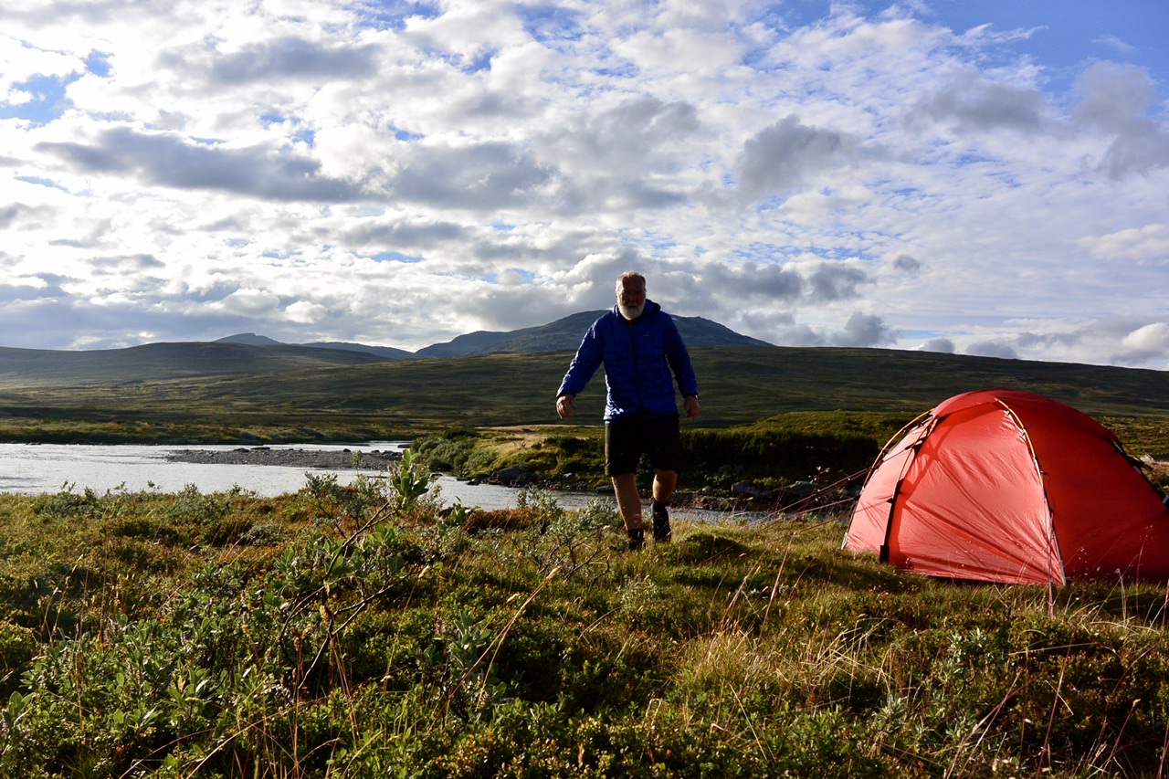
... on the way to Klimpfjäll; along the road till ... I had covered half the distance to Klimpfjäll and found this beautiful spot next to the river.

Mittwoch, 8. August 2018
114
Day 33 gröna bandet 600.2 km 🌤🌧
Pos N 64 50 099 E 14 05 038
Loc Stora Blåsjön 608 m
Acc Stuga
Dis 19,77 km
Sta 09.00
End 16.00
Tim 07.00
... on the way to Stora Blåsjön... a happy and dry day on the road! These boots are made for walking... Found a nice room with a view - an amazing view - across the lake! Just before the rain...
(foto)
(foto)
Dienstag, 7. August 2018
113
Day 32 gröna bandet 580.43 km ☁️
Pos N 64 40 930 E 14 04 792
Loc Camp at lake Lill-Jorm 5 km south of Jormvattnet 459 m
Acc Soulo
Dis 21,27 km
Sta 09.00
End 18.00
Tim 09.00 hrs
... on the way to Jormvattnet... following the road now from Väktarmon. ... had a fair share of swamps 😡. Wet, wet, wet - soft trail but hard walk! Fed up! ... and there will be more!
Montag, 6. August 2018
112
Day 31 gröna bandet 559.16 km ☁️ 🌧
Pos N 64 37 145 E 14 16 735
Loc Camp at bridge 5.5 km south of Väktarmon stugan at 803 m
Acc Soulo
Dis 27,34 km
Sta 09.00
End 20.30
Tim 11.30 hrs
Concerning the beginning tendinitis ... it calmed down after I had taken diclofenac and put on Voltaren. So I could reduce the dose to one tablet a day. 👍
Hiking a winter trail in summer...
...is something you can take into consideration, for instance to avoid walking along the road, but ... winter trails are led in a different way. They avoid forestry and rocky areas, go across wetlands, swamps and lakes - all are frozen. They cross rivers. They are marked with the diagonal red crosses, so you have a good orientation. Still you cannot follow them once a lake is in front of you and the next marking is on the other side. 😏Then you have to find your own path around, right or left! Lucky you, someone has been there before. Same with wetlands. Easy to imagine that the trail will be much longer! It’s not only that... the softer the trail, the harder the walk. And sooner or later your boots, your socks and finally your feet will be soaking wet!
Don’t dare and walk across real wet spots. Well, I did. Too lazy to walk aound! Stupid me! Sank in with one leg, the backpack pushing me into the mud! Had to belly crawl out. I was shocked but safe! No need to describe how I looked.
Once the direction of the trail changes, there are two crosses on one pole, both showing either direction. If you are too reluctant to observe that - like I did once - just because there is a convenient path ahead of you that you want to follow, you will end up in nowhereland and have to work your way back to the trail! The trail between Gäddede and Väktarmon, the one I followed, was a winter and summer trail according to the map, so there were bridges across the rivers. But in general it was a winter trail.
Of course, I didn’t reach the hut that evening though I tried hard. Finally, at half past eight, I gave in! After eleven and a half hours walking!
It was also beautiful though... large green wet pastures, wide open views, a terrific sky, reindeer watching me, then running away, splish-splashing water 💦 with their hoofs. I don’t want to miss it.
Treats along the trail II - Hjorton
And swamps are where ‘hjorton’ grow, cloudberries. There were so many! Red ones and the ripe yellow orange ones, big ones. They might taste a bit of swamps, as Paul says, but they are also a sweet, sour and refreshing treat, that quenches your thirst for fresh fruit! I ate loads!
(foto)
https://de.m.wikipedia.org/wiki/Moltebeere
Concerning the beginning tendinitis ... it calmed down after I had taken diclofenac and put on Voltaren. So I could reduce the dose to one tablet a day. 👍
Hiking a winter trail in summer...
...is something you can take into consideration, for instance to avoid walking along the road, but ... winter trails are led in a different way. They avoid forestry and rocky areas, go across wetlands, swamps and lakes - all are frozen. They cross rivers. They are marked with the diagonal red crosses, so you have a good orientation. Still you cannot follow them once a lake is in front of you and the next marking is on the other side. 😏Then you have to find your own path around, right or left! Lucky you, someone has been there before. Same with wetlands. Easy to imagine that the trail will be much longer! It’s not only that... the softer the trail, the harder the walk. And sooner or later your boots, your socks and finally your feet will be soaking wet!
Don’t dare and walk across real wet spots. Well, I did. Too lazy to walk aound! Stupid me! Sank in with one leg, the backpack pushing me into the mud! Had to belly crawl out. I was shocked but safe! No need to describe how I looked.
Once the direction of the trail changes, there are two crosses on one pole, both showing either direction. If you are too reluctant to observe that - like I did once - just because there is a convenient path ahead of you that you want to follow, you will end up in nowhereland and have to work your way back to the trail! The trail between Gäddede and Väktarmon, the one I followed, was a winter and summer trail according to the map, so there were bridges across the rivers. But in general it was a winter trail.
Of course, I didn’t reach the hut that evening though I tried hard. Finally, at half past eight, I gave in! After eleven and a half hours walking!
It was also beautiful though... large green wet pastures, wide open views, a terrific sky, reindeer watching me, then running away, splish-splashing water 💦 with their hoofs. I don’t want to miss it.
Treats along the trail II - Hjorton
And swamps are where ‘hjorton’ grow, cloudberries. There were so many! Red ones and the ripe yellow orange ones, big ones. They might taste a bit of swamps, as Paul says, but they are also a sweet, sour and refreshing treat, that quenches your thirst for fresh fruit! I ate loads!
(foto)
https://de.m.wikipedia.org/wiki/Moltebeere
Sonntag, 5. August 2018
111
Day 30 🌧 ☁️
Zero day - rainy day
Loc Gäddede, Campsite
Loc Gäddede, Campsite
Acc Stuga
It feels good to rest today.
I am worrying about my right foot. It’s swollen, tendons connecting foot and shin seem to be strained and stressed. There’s been some pain since I’ve left Valsjöbyn. Okay, I won’t go far today, just for coffee and chocolate. 😋
It feels good to rest today.
I am worrying about my right foot. It’s swollen, tendons connecting foot and shin seem to be strained and stressed. There’s been some pain since I’ve left Valsjöbyn. Okay, I won’t go far today, just for coffee and chocolate. 😋
Samstag, 4. August 2018
110
Day 29 gröna bandet 531,82 km 🌥 🌦🌥
Pos N 64 30 179 E 14 08 575
Loc Gäddede, Campsite 466 m
Acc Stuga
Dis 25 km
Sta 09.30
End 16.20
Tim 06.50
... on the way to Gäddede, end of stage II.
500 km walked, looking forward to a rest day at the campsite. Tomorrow is Sunday anyway and ‘yr’ forecast rain! Will I ever get rid of blisters?
Mein Versorgungspaket ist angekommen. Super! 👍 Aber vor dem Gewicht des Rucksacks in den kommenden Tagen graut mir. 👎 Verpflegung für 12 Tage! Da hilft nur... essen! Ab Hemavan kann ich in jeder zweiten Hütte einkaufen, dann wird es deutlich leichter.
Freitag, 3. August 2018
109
Day 28 gröna bandet 505,64 km 🌥
Pos N 64 20 558 E 14 22 562
Loc Hällingsåfallet 479 m
Acc Stuga
Dis 27.18 km
Sta 08.30
End 18.30
Tim 10 hrs
People on the trail - Jelin, 11 and Jul, 9

... with their two dogs Raija and Ris (... not sure about the correct spelling).
Kurz hinter den Sami sommarstugarna am Lobbersjön machte ich Pause an einem Flusslauf, um meine Wasserflasche zu füllen. Ab und an hatte ich Stimmen hinter mir gehört, konnte aber niemanden entdecken.
Zwei Kinder kamen mit zwei Hunden den Weg hinunter und querten den Bach. Jelin, 11 und Jul, 9 waren - wie sich später herausstellte - auf dem Weg zu ihrer Großmutter nach Munsvattnet. Ein einsamer Weg von zwei bis drei Stunden durch Fjäll und Wald. Das Mädchen sprach Englisch und so gelang eine gewisse Verständigung.
Ich hatte mich bezüglich des Wegs vergewissert. ‘This is the right path, I have walked this so many times!’ Sie hatten verstanden, dass mein Weg derselbe war. Ich hatte den Eindruck, dass sie gelegentlich warteten, so dass ich wieder aufschließen konnte. Denn beide, so klein sie waren, legten ein flottes Tempo vor! Raija zog kräftig an der Leine, die sich die Kinder abwechselnd um den Bauch banden. Ris lief frei und hörte aufs Wort.
‘Your dogs are very well trained and educated.’ ‘Yes’, she said, ‘that’s because we are Sami’! Beide trugen das typische Messer der Samen am Gürtel.
Als der See ‘Munsvattnet’ in der Ferne auftauchte, wies das Mädchen mit ausgestrecktem Arm darauf. Jul kam zu mir zurück gelaufen ‘See? The Lake. Man ser sjön.' Ja, sehr schön, dachte ich, mich an das Wortspiel erinnernd, das ich in den neunziger Jahren auf einem Poster entdeckt hatte, das die Gegend um den Rogen (See) darstellte.
Weiter unten, wir hatten das Fjäll längst hinter uns gelassen, um uns Wald und Sumpf, entdeckten die beiden Blaubeeren. Und ehe ich mich’s versah, streckte mir eine Kinderhand Moltebeeren entgegen. ‘Tack så mycket, Jul.’
Auf dem Weg lagen große Klumpen mit Blaubeeren. Bärenlosung? Raija schnüffelte einige Male und wälzte sich dann mit dem Rücken darin.
Plötzlich standen wir an einem Bachlauf, die Brücke zerstört! Kein Hinüberkommen ohne nasse Füße! Jelin und Jul zeigten sich unbeeindruckt: ’We try left’, gingen ein Stück und fanden eine Furt, an der wir den Bach queren konnten!
 ‘Do you hear?’ Ich konnte das Rauschen eines größeren Flusses vernehmen. ‘We will be at the bridge soon!’
Die Kinder hatten es nicht mehr weit. Jul lief jetzt mit den Hunden vorneweg. Jelin zeigte auf einen flachen Stein mitten auf dem Weg. Ein mit Filzstift geschriebener Hinweis auf den erwarteten Abzweig nach Hällingsåfallet. Den ‘Pfad’ hätte man leicht übersehen können. Hier, noch vor Munsvattnet trennten sich unsere Wege.
Ich war schwer beeindruckt von der Selbstverständlichkeit mit der sich diese beiden Kinder in dieser Landschaft bewegten! Selbstbewusst, sicher, offen und frei! Es sollte übrigens nicht lange dauern und ich hatte mich wieder einmal verlaufen. Aber das ist eine andere Geschichte.
People on the trail - Jelin, 11 and Jul, 9

... with their two dogs Raija and Ris (... not sure about the correct spelling).
Kurz hinter den Sami sommarstugarna am Lobbersjön machte ich Pause an einem Flusslauf, um meine Wasserflasche zu füllen. Ab und an hatte ich Stimmen hinter mir gehört, konnte aber niemanden entdecken.
Zwei Kinder kamen mit zwei Hunden den Weg hinunter und querten den Bach. Jelin, 11 und Jul, 9 waren - wie sich später herausstellte - auf dem Weg zu ihrer Großmutter nach Munsvattnet. Ein einsamer Weg von zwei bis drei Stunden durch Fjäll und Wald. Das Mädchen sprach Englisch und so gelang eine gewisse Verständigung.
Ich hatte mich bezüglich des Wegs vergewissert. ‘This is the right path, I have walked this so many times!’ Sie hatten verstanden, dass mein Weg derselbe war. Ich hatte den Eindruck, dass sie gelegentlich warteten, so dass ich wieder aufschließen konnte. Denn beide, so klein sie waren, legten ein flottes Tempo vor! Raija zog kräftig an der Leine, die sich die Kinder abwechselnd um den Bauch banden. Ris lief frei und hörte aufs Wort.
‘Your dogs are very well trained and educated.’ ‘Yes’, she said, ‘that’s because we are Sami’! Beide trugen das typische Messer der Samen am Gürtel.
Als der See ‘Munsvattnet’ in der Ferne auftauchte, wies das Mädchen mit ausgestrecktem Arm darauf. Jul kam zu mir zurück gelaufen ‘See? The Lake. Man ser sjön.' Ja, sehr schön, dachte ich, mich an das Wortspiel erinnernd, das ich in den neunziger Jahren auf einem Poster entdeckt hatte, das die Gegend um den Rogen (See) darstellte.
Weiter unten, wir hatten das Fjäll längst hinter uns gelassen, um uns Wald und Sumpf, entdeckten die beiden Blaubeeren. Und ehe ich mich’s versah, streckte mir eine Kinderhand Moltebeeren entgegen. ‘Tack så mycket, Jul.’
Auf dem Weg lagen große Klumpen mit Blaubeeren. Bärenlosung? Raija schnüffelte einige Male und wälzte sich dann mit dem Rücken darin.
Plötzlich standen wir an einem Bachlauf, die Brücke zerstört! Kein Hinüberkommen ohne nasse Füße! Jelin und Jul zeigten sich unbeeindruckt: ’We try left’, gingen ein Stück und fanden eine Furt, an der wir den Bach queren konnten!
 ‘Do you hear?’ Ich konnte das Rauschen eines größeren Flusses vernehmen. ‘We will be at the bridge soon!’
Die Kinder hatten es nicht mehr weit. Jul lief jetzt mit den Hunden vorneweg. Jelin zeigte auf einen flachen Stein mitten auf dem Weg. Ein mit Filzstift geschriebener Hinweis auf den erwarteten Abzweig nach Hällingsåfallet. Den ‘Pfad’ hätte man leicht übersehen können. Hier, noch vor Munsvattnet trennten sich unsere Wege.
Ich war schwer beeindruckt von der Selbstverständlichkeit mit der sich diese beiden Kinder in dieser Landschaft bewegten! Selbstbewusst, sicher, offen und frei! Es sollte übrigens nicht lange dauern und ich hatte mich wieder einmal verlaufen. Aber das ist eine andere Geschichte.
Donnerstag, 2. August 2018
108
Day 27 gröna bandet 478.46 km 🌤
Pos N 64 11 189 E 14 17 039
Loc Fjäll, 2.5 km south of bridge near Renvaktarstuga 950 m
Acc Soulo
↗️ 885 m
↘️ 358 m
↗️ 885 m
↘️ 358 m
Dis 24.83 km
Sta 08.20
End 17.20
Tim 09.00 hrs
Wir haben zunächst im Hofladen noch Tunnbröd und Ziegenkäse eingekauft, Paul hatte nichts gefrühstückt. Aber dann ging’s los, steil bergauf. Paul entschied sich spontan in zwei Tagen bis Gäddede durchzulaufen - 75 km.
Zum Glück traf ich ihn noch einmal oben in Vinklumpen. So konnten wir uns gemeinsam auf die Suche nach dem Pfad machen.
Aus vielen ATV (All Terrain Vehicle) Spuren wurde in der Nähe des Rentierzauns eine, die dann auch auf den Vinklumpen entsprechend dem GPS Pfad führte.
Hier zeigte sich eine sehr unterschiedliche Herangehensweise. Paul läuft gern direkt und quer durchs Gelände, Sumpf oder Wald. Über querliegende Bäume steigt er mit langen Beinen hinweg, ich muss Sie umständlich umrunden. Hier kann ich kräftemäßig nicht mithalten. Bin dann mit meinen Kräften schnell am Ende. Ich orientiere mich am GPS Pfad, an vorhandenen Spuren, versuche diese in Übereinstimmung zu bringen.
Wie auch immer, wir haben den Pfad gefunden und Paul zog dann wieder seiner Wege!
Hier oben im Fjäll war es großartig. Schöne, offene Landschaft mit weiten Horizonten. Befreiend, endlich, nach Tagen wieder raus aus dem Wald.
Eigentlich wollte ich noch die zweieinhalb Kilometer bis zur Brücke gehen. Aber dann zogen so dunkle Wolken auf, dass ich mich blitzartig entschloss das Zelt aufzubauen. Wasser war in der Nähe, schnell ein ebenes Plätzchen ausgesucht! Dieses Mal alle Heringe gesetzt! Es fing an kräftig zu blasen! Noch schnell ein Foto. Kaum hatte ich alles im Zelt, fing es an zu schütten. Geschafft - warm und trocken!
Als es drei Stunden später aufhörte zu regnen, war die ganze Umgebung in Wolken gehüllt!
(foto)
Wir haben zunächst im Hofladen noch Tunnbröd und Ziegenkäse eingekauft, Paul hatte nichts gefrühstückt. Aber dann ging’s los, steil bergauf. Paul entschied sich spontan in zwei Tagen bis Gäddede durchzulaufen - 75 km.
Zum Glück traf ich ihn noch einmal oben in Vinklumpen. So konnten wir uns gemeinsam auf die Suche nach dem Pfad machen.
Aus vielen ATV (All Terrain Vehicle) Spuren wurde in der Nähe des Rentierzauns eine, die dann auch auf den Vinklumpen entsprechend dem GPS Pfad führte.
Hier zeigte sich eine sehr unterschiedliche Herangehensweise. Paul läuft gern direkt und quer durchs Gelände, Sumpf oder Wald. Über querliegende Bäume steigt er mit langen Beinen hinweg, ich muss Sie umständlich umrunden. Hier kann ich kräftemäßig nicht mithalten. Bin dann mit meinen Kräften schnell am Ende. Ich orientiere mich am GPS Pfad, an vorhandenen Spuren, versuche diese in Übereinstimmung zu bringen.
Wie auch immer, wir haben den Pfad gefunden und Paul zog dann wieder seiner Wege!
Hier oben im Fjäll war es großartig. Schöne, offene Landschaft mit weiten Horizonten. Befreiend, endlich, nach Tagen wieder raus aus dem Wald.
Eigentlich wollte ich noch die zweieinhalb Kilometer bis zur Brücke gehen. Aber dann zogen so dunkle Wolken auf, dass ich mich blitzartig entschloss das Zelt aufzubauen. Wasser war in der Nähe, schnell ein ebenes Plätzchen ausgesucht! Dieses Mal alle Heringe gesetzt! Es fing an kräftig zu blasen! Noch schnell ein Foto. Kaum hatte ich alles im Zelt, fing es an zu schütten. Geschafft - warm und trocken!
Als es drei Stunden später aufhörte zu regnen, war die ganze Umgebung in Wolken gehüllt!
(foto)
Mittwoch, 1. August 2018
107
Treats along the trail I - Hallon 😋
On the way to Valsjöbyn Paul and I discovered hallon (raspberries) as a very special treat. After all this muesli and freeze dried food - the typical trekking food - we had developed a longing for fresh fruit and vitamins! Red and ripe, smiling at us every now and then! None left along the road now. 😏 We picked a kilo each!

On the way to Valsjöbyn Paul and I discovered hallon (raspberries) as a very special treat. After all this muesli and freeze dried food - the typical trekking food - we had developed a longing for fresh fruit and vitamins! Red and ripe, smiling at us every now and then! None left along the road now. 😏 We picked a kilo each!

106
Day 26 gröna bandet 453.63 km ☁️🌤
Pos N 64 04 049 E14 08 766
Loc Valsjöbyn, Bränna Getgård 438 m
Acc Stuga
Dis 16.16 km
Sta 11.00
End 15.30
Tim 04.30 hrs
Keso get, keso ko och lingon sylt - vi har fika!
 (foto)
Keso get, keso ko och lingon sylt - vi har fika!
Dienstag, 31. Juli 2018
105
Day 25 gröna bandet 437.47 km ☁️🌥
Pos N 63 58 412 E 14 09 943
Loc Rötviken Camping 373 m
Acc Soulo
Dis 24,96 km
Sta 09.45
End 17:45
Tim 08.00 hrs
Montag, 30. Juli 2018
104
Day 24 gröna bandet 412.51 km 🌤
... on the way to Jänsmässholmen, but then I felt like going on... and on, and on ... and caught up with Paul :) - German reunification after three weeks.
Pos N 63 86 325 E 13 91 358
Pos N 63 86 325 E 13 91 358
Loc Ansätten 713 m
Acc Room
Dis 33.02 km
Sta 08.15
End 20.15
Tim 12 hrs


Sonntag, 29. Juli 2018
103
People on the trail - Stig
 Stig Nilsson is one of the trail angels gröna bandet hikers like to meet on their way. He - in his mid-seventies - takes care of the Bystuga, the villagers‘ community house at Olden. Local people go there for social events, but also using the sauna, or simply having a shower. Not all (summer) houses in the area have showers. But the house - a former school building - also offers accommodation, a kitchen, a comfortable living room and a generous terrace!
 Stig is a dedicated follower of gb hikers, follows them online, reads their websites.
No wonder, he knew about me and my arrival. When I arrived, he was busy otherwise, but had left this welcoming note at the door. So I went in and made myself at home!
Later he invited me to have lunch with him, managed my washing and gave important advice on the trail.
... I stayed another day - not only because of the rain. Tack så mycket, Stig.
102
Day 23 🌧⛈
Zero day
Loc Olden, Bystuga 382 m
I felt exhausted and like having a zero day. My feet, my body need to rest. Blisters caused pain yesterday. And indeed, there is a new one, underneath and below the healed one. :(
On the other hand I felt like moving forward. Just a lucky coincidence, today is a rainy day, ’yr’ forecast thunderstorms all afternoon. Probably wise to stay. ;). What a convenient excuse!
Zero day
Loc Olden, Bystuga 382 m
Acc Room
I felt exhausted and like having a zero day. My feet, my body need to rest. Blisters caused pain yesterday. And indeed, there is a new one, underneath and below the healed one. :(
On the other hand I felt like moving forward. Just a lucky coincidence, today is a rainy day, ’yr’ forecast thunderstorms all afternoon. Probably wise to stay. ;). What a convenient excuse!
Samstag, 28. Juli 2018
101
Day 22 gröna bandet 379.49 km ☀️🌤
Pos N 63 41 777 E 13 37 547
Loc Olden, Bystuga 382 m
Acc Room
Dis 27.33 km
Sta 08.45
End 16.45
Tim 08.00 hrs
100
Going solo ... another lonesome wanderer. Beautiful reindeer at lake Juvuln.


Many days later, ... Mary-Sue, a hiker I met at Kvikkjokk, referred to a reindeer that reminded her of me ...
'Yesterday I had a wonderful hikingday and came across a whole herd of reindeer, passing by me a few meters away. It was a wonderful moment that I enjoyed very much. When the herd past by, a big white raindeer came by. Somehow he made me think of you. He was part of the herd, going the same direction, but he went down his own path at his own pace.'


Many days later, ... Mary-Sue, a hiker I met at Kvikkjokk, referred to a reindeer that reminded her of me ...
'Yesterday I had a wonderful hikingday and came across a whole herd of reindeer, passing by me a few meters away. It was a wonderful moment that I enjoyed very much. When the herd past by, a big white raindeer came by. Somehow he made me think of you. He was part of the herd, going the same direction, but he went down his own path at his own pace.'
... und ich denke darüber nach, was es ausmacht alleine zu gehen. Go solo! ... ist das Motto, das ich von Audrey Sutherland (https://www.patagonia.com/blog/2015/03/go-simple-go-solo-go-now-the-life-of-audrey-sutherland/) übernommen habe.
Allein zu gehen ... ist einfach und schwierig zugleich. Der Rucksack ist schwer oder leicht, der Pfad steinig und steil oder eben und gut zu laufen; den Weg zu gehen ist Routine oder voller überraschender Erlebnisse. Du bist alleine damit! Es zieht dich runter, es baut dich auf, es macht dich einsam und bringt dich mit Menschen zusammen. Du triffst wenige Menschen, aber die Begegnungen sind sehr intensiv. Kleine Gesten bekommen großes Gewicht. Es fordert dich, Befürchtungen und Ängste nehmen Raum, aber du gewinnst Vertrauen in die eigenen Fähigkeiten. Überschwängliche morgendliche Pläne - was kostet die Welt? - schrumpfen zu realistischen im Laufe des Tages. Aus Ungestüm wird Geduld. An manchen Tagen steckst du voller Energie, dir ist nach Ruhe an anderen. Du blickst auf die Welt um dich herum und nach innen. Du singst und du tanzt. Du schleppst dich über Hänge und Steinfelder, fällst und stehst wieder auf. Die Natur überwältigt dich mit einer unvorstellbaren Kraft, das kann schön sein und erschreckend, herausfordernd oder überfordernd. Du schöpfst aus dem Vollen ... und du liebst das Leben - das alles nur für mich - wäre es nicht schön, all dies zu teilen?
Freitag, 27. Juli 2018
99
Day 21 gröna bandet 352.16 km 🌤☀️
Pos N 63 68 843 E 13 29 444
Loc Juvuln (See)
Acc Soulo
Dis 20.69 km
Sta 11.30
End 18.10
Tim 06.40 hrs
Starting later today: sitting in the kitchen enjoying coffee in the morning. And another,... and another... who knows when it‘s possible to use the cooker again - still eldningsforbud!!! No open fires - including use of small camp stoves - allowed in Jämtland!
Starting later today: sitting in the kitchen enjoying coffee in the morning. And another,... and another... who knows when it‘s possible to use the cooker again - still eldningsforbud!!! No open fires - including use of small camp stoves - allowed in Jämtland!
Donnerstag, 26. Juli 2018
98
Day 20 gröna bandet 331.47 km ☀️
Pos N 63 42 052 E 12 57 240
Loc Kallsedet Fjällcenter 288 m
Acc Soulo
Dis 32.74 km
Sta 09.00
End 18.30
Tim 09.30 hrs
While walking along the long and winding road, following the road marking, I just couln’t get this song out of my ears.
While walking along the long and winding road, following the road marking, I just couln’t get this song out of my ears.
I walk the line by Johnny Cash
I keep a close watch on this heart of mine
I keep my eyes wide open all the time
I keep the ends out for the tie that binds
Because you're mine, I walk the line
I find it very, very easy to be true
I find myself alone when each day is through
Yes, I'll admit that I'm a fool for you
Because you're mine, I walk the line
As sure as night is dark and day is light
I keep you on my mind both day and night
And happiness I've known proves that it's right
Because you're mine, I walk the line
You've got a way to keep me on your side
You give me cause for love that I can't hide
For you I know I'd even try to turn the tide
Because you're mine, I walk the line
I keep a close watch on this heart of mine
I keep my eyes wide open all the time
I keep the ends out for the tie that binds
Because you're mine, I walk the line
Because you're mine, I walk the line
Mittwoch, 25. Juli 2018
97
Day 19 gröna bandet 298,73 km 🌤⛈🌤
Pos N 63 33 319 E 13 01 624
Loc Kallrör Gästhem 370 m
Acc Room
Dis 32.15 km
Sta 08.00
End 20.15
Tim 12.15 hrs
...off the beaten track
The trail from Sölvsved looked great on the map, only a few hundred metres to go cross country near Högvallen. Then a connecting road to the north! My gps trail even showed a continueing trail. 👍
After a coffee and good advice from local people EvaLis and Lennart I hit the trail. Soon the path led me off my gps trail, at an right angle. Shall I follow the path? Or have I missed the gps trail?
I went back and found a - then - visible path following my gps trail. Shall I go here? I did. Often hard to discover, but exactly on my gps track. It was incredibly difficult to walk though, crossing fallen trees, across swamps, up and down steep slopes. Will this go on for hours?
A thunderstorm hit and rain poured down. My gps played bingo despite the fact that I had locked the display. 😡
I lost the trail or the faint idea of a path, decided to give up and return. Put gps on trackback! After the rain I could hardly see the path I had just walked, lost and found it several times. I had to suppress panic taking over.
It was so a-maze-ingly beautiful around me. So wild and wonderful. Look at that tree lying across the path. Haven’t I seen that before? Oh no, I am following the path in the wrong direction!
If in danger or in doubt
Run in circles scream and shout!
Well, I found back and decided to follow the road to Kallsedet! Hit the road, Jack. And don’t you look back...
...off the beaten track
The trail from Sölvsved looked great on the map, only a few hundred metres to go cross country near Högvallen. Then a connecting road to the north! My gps trail even showed a continueing trail. 👍
After a coffee and good advice from local people EvaLis and Lennart I hit the trail. Soon the path led me off my gps trail, at an right angle. Shall I follow the path? Or have I missed the gps trail?
I went back and found a - then - visible path following my gps trail. Shall I go here? I did. Often hard to discover, but exactly on my gps track. It was incredibly difficult to walk though, crossing fallen trees, across swamps, up and down steep slopes. Will this go on for hours?
A thunderstorm hit and rain poured down. My gps played bingo despite the fact that I had locked the display. 😡
I lost the trail or the faint idea of a path, decided to give up and return. Put gps on trackback! After the rain I could hardly see the path I had just walked, lost and found it several times. I had to suppress panic taking over.
It was so a-maze-ingly beautiful around me. So wild and wonderful. Look at that tree lying across the path. Haven’t I seen that before? Oh no, I am following the path in the wrong direction!
If in danger or in doubt
Run in circles scream and shout!
Well, I found back and decided to follow the road to Kallsedet! Hit the road, Jack. And don’t you look back...
Dienstag, 24. Juli 2018
96
Day 18 gröna bandet 266.58 km 🌤
Pos N 63 27 105 E 13 21 501
Loc Krokholmen 396 m
Acc Soulo
Dis 16.21 km
Sta 08.50
End 15.05
Tim 06.15 hrs
Genial gescheitert
Es gibt bei Krok - auf der Karte - einen Pfad, der eine Verbindung nach Norden in Richtung Djupsjö und weiter nach Olden herstellt. Auch mein GPS zeigt diesen Weg an. Ich fand den Zugang an der Straße und nach etwas Suchen auch den Einstieg in den Pfad. Hier und da eine kleine Markierung - alles bestens. Die Markierungen hörten auf, aber der Pfad führte mich bis an den Fahrweg ( den ich auch hätte nehmen können) südlich Västest Kvarntjärn.
Direkt gegenüber sollte der Pfad weiterlaufen... vielleicht ein bisschen rechts? Oder links? Ich probierte rechts ... weit kam ich nicht. Okay. Rucksack bleibt am Weg, ... gps kommt mit. Das Gelände ist extrem unübersichtlich! Ich suche... kein Pfad, verlaufe mich, finde aber auf den Weg zurück. Was tun?
Weiter unten am Weg stehen ein paar Hütten, ich könnte die Leute fragen. Niemand dort, Sommerhäuser. Ich fülle mein Flasche am See und gehe wieder zurück, der Pfad muss doch zu finden sein. Also nochmal rein in die Wildnis, dem gps Pfad folgen... hier muss er doch sein!
Es gibt keinen Pfad! Bittere Erkenntnis! Ich mache mich auf den Rückweg - doch wohin? Beim Suchen bin ich rechts und links und kreuz und quer gegangen. Wo geht’s zum Weg zurück? Um mich herum Wildnis, umgefallenene Bäume, Sträucher, Felsen, tiefe Löcher im Gelände! Ein mühsames Unterfangen, aber die Sonne und mein GPS führen mich auf den Weg zurück!
Ich bitte Svante um Rat. Er beschreibt eine andere Route von Sölvsved aus. Ich schöpfe wieder Mut, stelle mein Zelt an der wunderschönen Badestelle auf Kroksholmen auf und genieße den Nachmittag. Allerdings ohne Kaffee, denn es herrscht absolutes Feuerverbot! Auch das Abendessen bleibt kalt! Kaltes Wasser - das kommt in die Tüte!
Genial gescheitert
Es gibt bei Krok - auf der Karte - einen Pfad, der eine Verbindung nach Norden in Richtung Djupsjö und weiter nach Olden herstellt. Auch mein GPS zeigt diesen Weg an. Ich fand den Zugang an der Straße und nach etwas Suchen auch den Einstieg in den Pfad. Hier und da eine kleine Markierung - alles bestens. Die Markierungen hörten auf, aber der Pfad führte mich bis an den Fahrweg ( den ich auch hätte nehmen können) südlich Västest Kvarntjärn.
Direkt gegenüber sollte der Pfad weiterlaufen... vielleicht ein bisschen rechts? Oder links? Ich probierte rechts ... weit kam ich nicht. Okay. Rucksack bleibt am Weg, ... gps kommt mit. Das Gelände ist extrem unübersichtlich! Ich suche... kein Pfad, verlaufe mich, finde aber auf den Weg zurück. Was tun?
Weiter unten am Weg stehen ein paar Hütten, ich könnte die Leute fragen. Niemand dort, Sommerhäuser. Ich fülle mein Flasche am See und gehe wieder zurück, der Pfad muss doch zu finden sein. Also nochmal rein in die Wildnis, dem gps Pfad folgen... hier muss er doch sein!
Es gibt keinen Pfad! Bittere Erkenntnis! Ich mache mich auf den Rückweg - doch wohin? Beim Suchen bin ich rechts und links und kreuz und quer gegangen. Wo geht’s zum Weg zurück? Um mich herum Wildnis, umgefallenene Bäume, Sträucher, Felsen, tiefe Löcher im Gelände! Ein mühsames Unterfangen, aber die Sonne und mein GPS führen mich auf den Weg zurück!
Ich bitte Svante um Rat. Er beschreibt eine andere Route von Sölvsved aus. Ich schöpfe wieder Mut, stelle mein Zelt an der wunderschönen Badestelle auf Kroksholmen auf und genieße den Nachmittag. Allerdings ohne Kaffee, denn es herrscht absolutes Feuerverbot! Auch das Abendessen bleibt kalt! Kaltes Wasser - das kommt in die Tüte!
Montag, 23. Juli 2018
95
Day 17 gröna bandet 250.37 km 🌤
Pos N 63 26 004 E 13 22 207
Loc Kallsjön, Bonäset - Krok 388 m
Acc Soulo
Dis 32.05 km
Sta 08.50
End 18.25
Tim 09.35 hrs
Sonntag, 22. Juli 2018
94
Day 16 ☀️
Zero day
Loc STF Åre Torg 467 m
My feet need to rest. ;)
My clothes to be washed,
The supply parcel to be picked up ... got it! 👍

Zero day
Loc STF Åre Torg 467 m
Acc Room
My feet need to rest. ;)
My clothes to be washed,
The supply parcel to be picked up ... got it! 👍
Samstag, 21. Juli 2018
93
Day 15 gröna bandet 218,32 km 🌤
Pos N 63 24 049 E 13 04 669
Loc STF Åre Torg 467 m
Acc Room
Dis 42,13 km
Sta 08.30
End 19.45
Tim 11.15 hrs
Iditarod
42 kilometres - I did not know, I could do that. The one and only marathon I ran was in 2002 - without a backpack. ;) When I started in the morning, I thought it was worth a try. I left with some skepticism though, the backpack weighed 20 kg. But there was not much else, the cap, shorts and a shirt, boots, socks, poles. A sunny and warm day with a little rain in the afternoon. And I wanted to save a day or two. Wasn’t I already five days behind my schedule due to blisters!
I followed the road, tried to keep up up an average speed of 4.5 km including breaks. And by three o’clock I was down at the bridge crossing Indalensälven after 27 km. Only another 15 km to go. Rain forced me to break and I ate something.
The path along the river became slippery. Of course I lost balance and the heavy backpack knocked me down. Tired and weary I slowed down a bit. Later I followed the road again and finally crept into the station.
Blisters? Yes, I think, but I’ll check tomorrow! The showers are hot and the sauna is heated ... aahhhh, relax now.
Freitag, 20. Juli 2018
92
Skogsbränderna i länet
Waldbrände in Schweden - aktuelle Info 🔥
https://www.lansstyrelsen.se/jamtland/privat.html#0
https://www.sosalarm.se/trender--analyser/lagesbild-brand/
https://www.krisinformation.se/english
Waldbrände in Schweden - aktuelle Info 🔥
https://www.lansstyrelsen.se/jamtland/privat.html#0
https://www.sosalarm.se/trender--analyser/lagesbild-brand/
https://www.krisinformation.se/english
Abonnieren
Posts (Atom)